AGRI SENSE
Creator:
Heinrich Zaunschirm
Curator's Note
Updated: March 2025
Agri Sense envisions a future where precision farming becomes effortless, efficient, and truly sustainable. By automating data collection from both air and ground, it provides farmers with precise, real-time insights into soil health, crop conditions, and environmental factors—without adding to their already demanding workload. This means fewer wasted resources, healthier crops, and higher yields, all while reducing agriculture’s environmental footprint. With labor shortages and climate change intensifying pressure on the industry, a seamless, autonomous system like Agri Sense is no longer a distant vision—it’s a necessary step forward. By bridging the gap between data collection, analysis, and action, this project empowers farmers to make smarter, faster decisions that benefit both their livelihoods and the planet.
EDIT: The following link leads to the Thorvald platform, which is a different approach to the same solution I just found. Their technical development began before this design vision was formed.
Abstract
Keeping up with the rising food demand of the world’s growing population is a big challenge for farmers. The scarcity of resources, coupled with agriculture’s environmental impact, creates a need for more efficient and sustainable agricultural practices. Precision farming is a promising approach that uses location-based data collection on the field for making informed decisions in crop management.
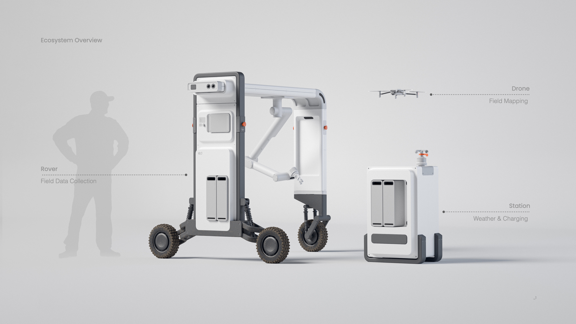
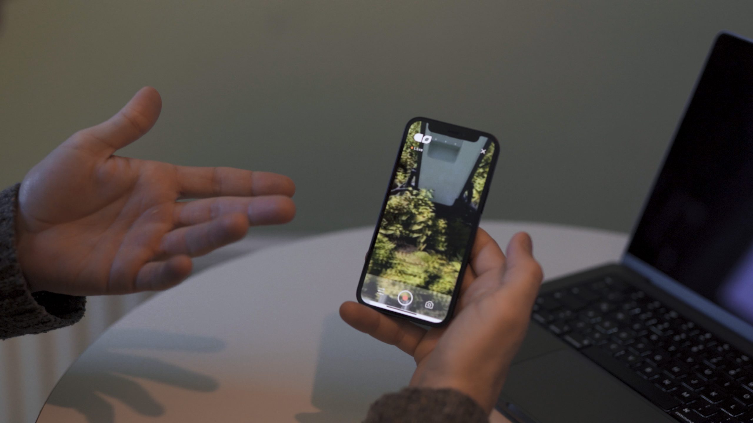
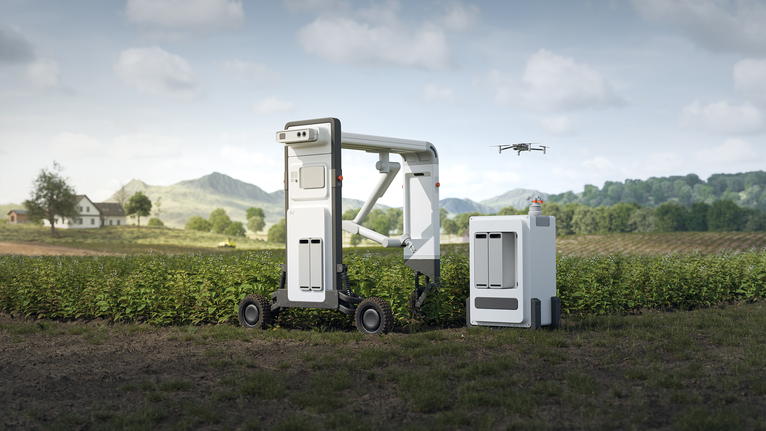
The autonomous data collection system Agri Sense can help farmers with this by mapping out their fields with an intelligent drone, collecting precise physical data of soil and crop with an autonomous rover, and creating location-based data implementation strategies in an intuitive software. Measuring local weather data and monitoring plants also aids farmers in predicting and preventing pests and diseases.
"Agriculture is not crop production as popular belief holds – it's the production of food and fiber from the world's land and waters. Without agriculture it is not possible to have a city, stock market, banks, university, church or army. Agriculture is the foundation of civilization and any stable economy."
– Allan Savory
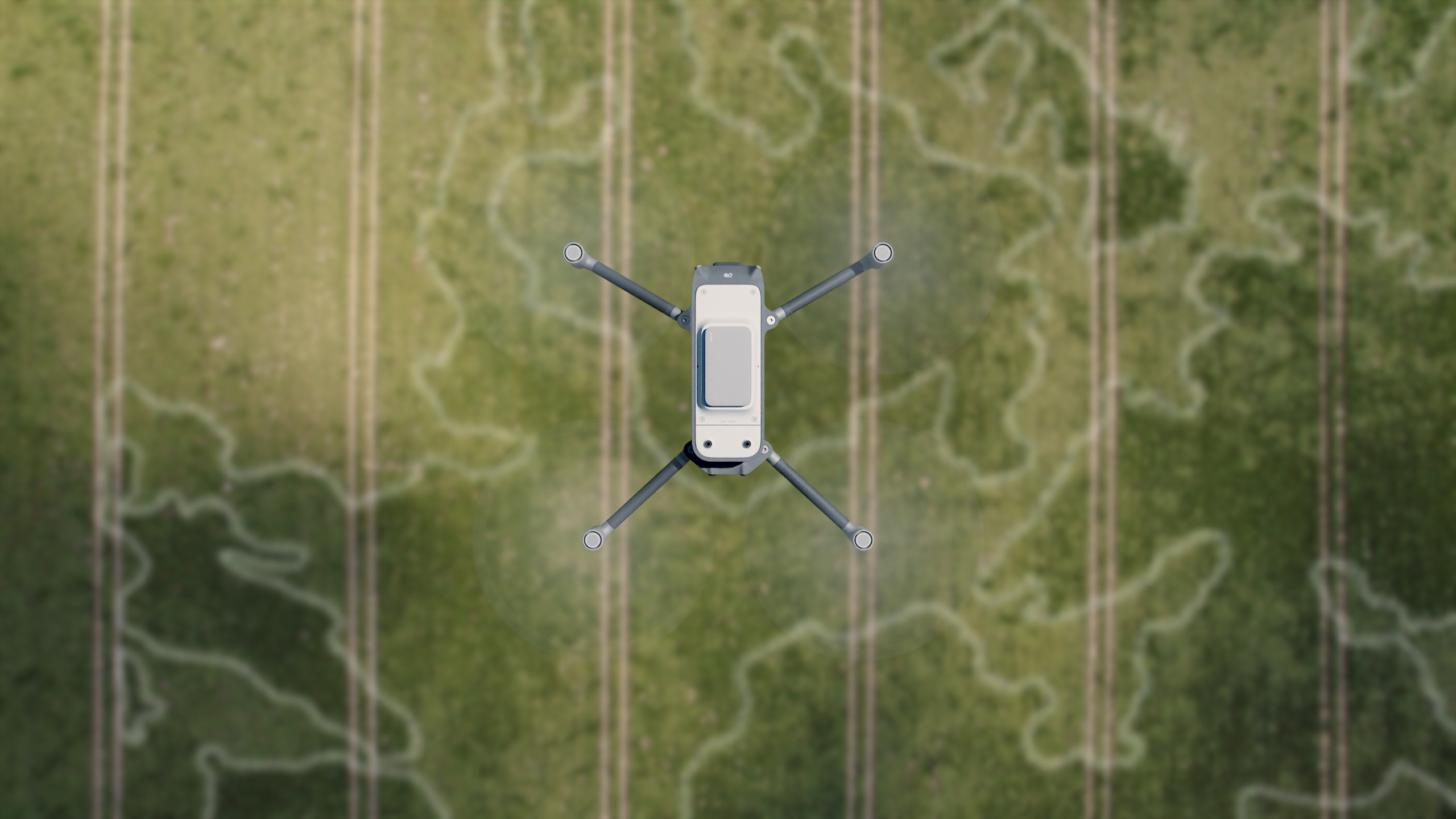
The drone can quickly fly over the fields and map them out. It can estimate certain crop data like nutrition using multispectral imaging , and it then divides the field into sections based on the collected data. The drone can be automatically charged and stored in a drone hub that can be attached to the station.
Precision Farming is a crop cultivation approach that utilizes location-based measurements of field data for making informed decisions for applying resources such as fertilizer and water. This approach reduces the total amount of spent resources while increasing the overall yield. Knowing how much resources are actually needed also reduces environmental impact.
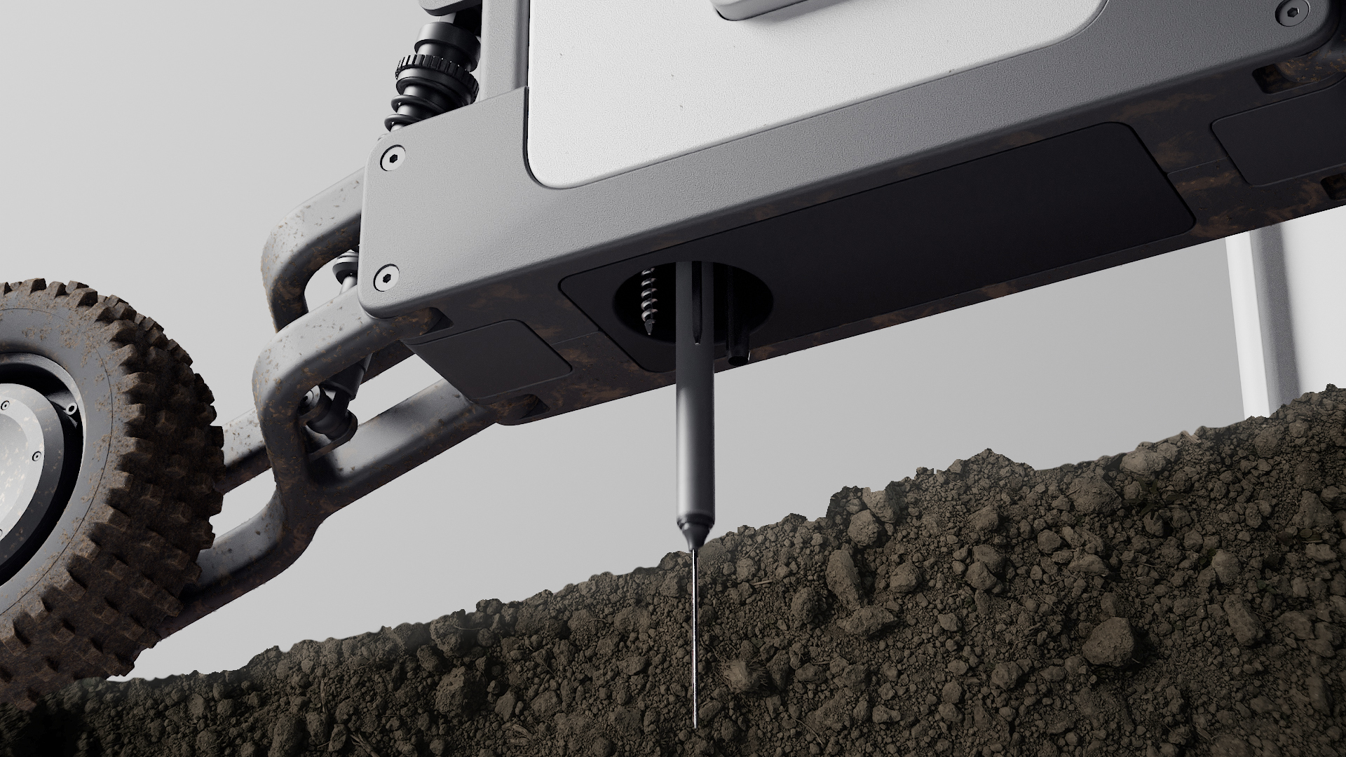
Soil sampling: A hydraulic piston located in the main body of the rover can switch between a range of sensor probes, a soil sampler, a compaction tester and a spectrophotometer to analyze different soil properties and take samples.
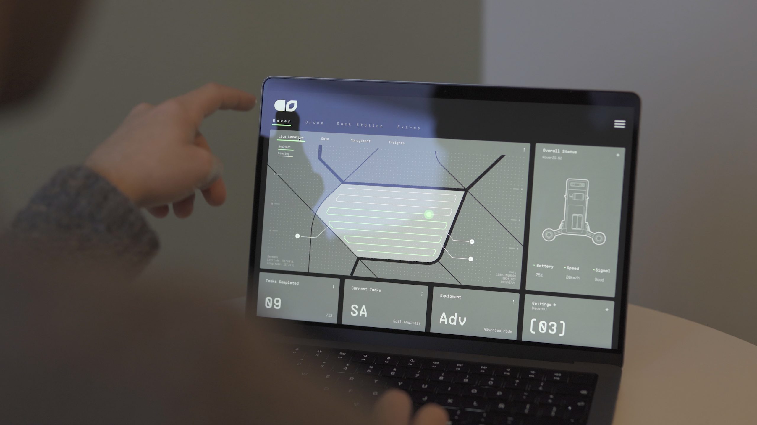
By continuously measuring the soil quality and the crop health, farmers can get valuable, precise information about their fields and the crop in the Agri Sense software. The software has extensive information about the majority of crops and helps the farmer to the develop and deploy the right strategies to improve yields and reduce costs and environmental impact. The farmer can also train the software with his own special knowledge and improve the functionality of the system. This also helps to pass on knowledge to future generations of farmers.